Resolving Land-Use Disputes: Boundaries, Routes, and Resource Damage
In many rural and semi-rural communities, land is not just a physical space; it is the foundation of livelihoods, identity, and survival. When boundaries are unclear, grazing routes are blocked, or crops and pasture are damaged, people often feel that their way of life is under threat. What may appear to be a simple disagreement over land use can quickly escalate into anger, fear, and mistrust, especially when people already face pressure from climate change, population growth, or shrinking resources.
These disputes often arise because expectations differ, agreements are unclear, or changing conditions force people to make difficult choices. When such tensions are ignored or handled solely through blame and punishment, they tend to resurface and grow stronger. Communities then find themselves caught in cycles of accusation, retaliation, and violence that damage relationships and weaken social cohesion.
This section focuses on ways communities can resolve land-use disputes in a fair, transparent, and respectful manner for everyone involved. It emphasises joint fact-finding, open dialogue, and community-agreed standards for assessing damage and determining responsibility. Rather than asking who should win, the approaches here ask how harm can be repaired, trust rebuilt, and future conflict prevented. By centring people’s experiences and needs, these processes help communities move beyond confrontation and toward cooperation, ensuring that land remains a source of life rather than division.
This section presents practical, field-tested interventions that have been shown to support the effective prevention and management of land- and resource-related conflicts between farmers and herders. The recommendations draw on documented practice, expert knowledge, and extensive field experience and reflect approaches that have proven workable in real community settings rather than theoretical models.
The best practices outlined in the Kaduna State guidelines are informed by 64 Key Informant Interviews (KIIs) with traditional and religious leaders, justice actors, farmer and herder representatives, civil society practitioners, and local government officials, complemented by Focus Group Discussions with 12 subject-matter experts. Together, these engagements provide a strong evidence base grounded in local realities and professional experience.
In this context, best practices are understood as approaches and processes that have been successfully applied, demonstrate local legitimacy, and contribute to fair, timely, and durable outcomes. Each practice has been assessed for its effectiveness, inclusiveness, and relevance to Kaduna State’s social and security environment.
The recommendations are intended to serve as a practical reference for those directly involved in land governance and dispute prevention, including traditional and community leaders, mediators, arbitrators, legal practitioners, religious leaders, local authorities, development actors, and other professionals working to prevent and resolve farmer–herder conflicts.
A. Resolve Boundary and Route Disputes Through Joint Delineation
Joint delineation is a collaborative process where farmers, herders, and community representatives come together to identify, clarify, and agree on disputed boundaries and routes. Rather than relying on one-sided claims, this approach allows all parties to contribute their knowledge and reach a shared understanding of where land and pathways lie.
Practitioners should facilitate joint delineation processes to resolve disputes over farm boundaries, grazing routes, corridors, and access paths. These processes should involve the affected parties, elders, traditional leaders, women, youth, and neighbouring communities where relevant. Joint identification of contested areas and historical use patterns reduces mistrust, corrects misunderstandings, and replaces confrontation with shared understanding.
Joint delineation should begin with dialogue, followed by joint visits to the disputed site and participatory mapping using local landmarks. All parties should have the opportunity to explain their perspectives and propose adjustments. Once agreement is reached, the delineation should be publicly validated and recorded through maps, physical markers, or community testimony and referenced in future mediation or land-use planning. By seeing and agreeing together, communities transform contested claims into shared reference points that support lasting peace.
Strongly Recommended
B. Apply the conflict onion model to identify the interests behind a position and ultimately uncover the underlying needs, fears, and desires.
The Onion Model is a simple conflict analysis tool that helps people look beyond visible demands to understand the deeper reasons behind a dispute. It distinguishes between positions (what people say they want), interests (why they want it), and needs (the deeper concerns that must be met for people to feel secure and respected).
Practitioners should use the Onion Model to guide dialogue between farmers and herders during disputes over land, routes, or resource damage. By helping each party move beyond fixed positions and explore their underlying interests and needs, the Onion Model creates space for empathy, reduces hostility, and supports the development of solutions that address what truly matters to everyone involved.
During mediation, facilitators should encourage each party first to express their position, then gently ask why the issue matters to them and what they fear losing. These conversations can reveal shared needs such as livelihood security, safety, dignity, and belonging, even when positions appear opposed. By focusing on these deeper layers, communities can identify options that satisfy both sides, making agreements more realistic, respectful, and lasting.
Strongly Recommended
C. Use the conflict-tree to enhance respect and understanding.
The Conflict Tree is a simple visual tool that helps farmers and herders understand how visible disputes over land, routes, or crop damage grow from deeper, shared problems. It shows that what people see on the surface, such as quarrels, threats, or violence, are the branches of a conflict. At the same time, the real causes lie beneath in the roots, including water scarcity, unclear agreements, fear, or lack of communication.
Practitioners should use the Conflict Tree during dialogue and mediation processes to help farmers and herders explore the underlying causes and impacts of their disputes. By encouraging both sides to reflect on what lies beneath the conflict, the tool shifts the conversation away from blame and toward shared understanding. This process supports empathy, reduces hostility, and creates space for solutions that address the real sources of tension.
During community dialogue or mediation, facilitators can draw a simple tree and guide participants to describe the main problem, its root causes, and its effects on people’s lives. As farmers and herders recognise that many of the roots and impacts are shared, they begin to see one another not as enemies but as partners facing similar challenges. The Conflict Tree then serves as a foundation for identifying joint actions, such as reopening routes, improving communication, or revising agreements, to prevent future disputes and strengthen relationships.
Strongly Recommended
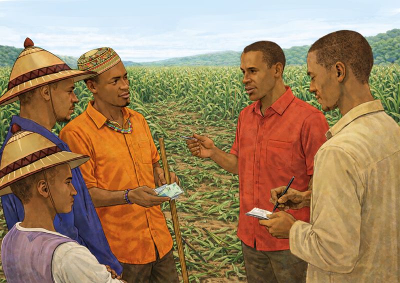
D. Conduct Transparent Crop Damage Assessment
A collaborative, open process for transparent crop damage assessment is essential for fairly determining the extent of damage, its cause, and its impact on the affected farmer or herder. By establishing shared facts, this process moves beyond suspicion and blame, ensuring that subsequent decisions on compensation or repair are perceived as fair.
Practitioners should support farmers, herders, and trusted community representatives in jointly assessing crop or pasture damage, using clear, commonly agreed criteria. Both sides should be present and heard, and neutral community members should be involved to ensure fairness. Transparency in the assessment process builds trust and reduces the risk of retaliation.
Assessments should be carried out as soon as possible through a joint visit to the affected area. The group should agree on what was damaged, the extent of the damage, and the likely causes, taking into account crop type, growth stage, and the affected area. Parties involved should share the findings openly and record the findings in simple ways: oral, written, or visual, so that they can guide dialogue, compensation, and future prevention efforts.
Strongly Recommended
E. Agree on Fair Ways to Compensate for Loss and Damage
This refers to community-agreed processes for deciding how harm caused by crop damage, pasture loss, blocked routes, or other land-use incidents is repaired in ways that are fair, respectful, and restorative. The goal is not punishment, but to restore livelihoods, dignity, and trust between farmers and herders. Practitioners should support farmers, herders, and community leaders in jointly agreeing on clear, fair ways to assess damage and determine appropriate compensation. These agreements should be based on community-accepted criteria, reflect local realities, and ensure that compensation is proportionate, timely, and focused on restoring relationships rather than assigning blame.
Community leaders, mediators and practitioners should openly discuss and agree on what counts as damage, how its value is determined, and what forms of compensation are acceptable, whether in cash, labour, produce, fodder, or other in-kind support. These agreements should be publicly acknowledged and used as reference points during mediation. When applied consistently, they reduce arguments, prevent retaliation, and help communities move forward after harm has occurred.
Strongly Recommended
Best Practices on Resolving Land Disputes: Boundaries, Routes, and Resource Management
- Dispute resolution should follow a layered approach that starts with community dialogue and fact-finding, includes clear determinations of liability by recognised leaders, and allows escalation to formal institutions when agreements are violated. This balance of dialogue and enforcement provides deterrence, sustains compliance, and reflects the more structured conflict environment in the state. In Line with Literature Research
- Boundary and route disputes are most effectively resolved through physical, on-site identification of landmarks and paths during mediation, rather than relying only on verbal claims. Seeing the land together reduces ambiguity and limits narrative manipulation. Conduct joint site visits with both parties, ward heads, Ardos, and witnesses; use natural landmarks such as trees, streams, and roads to describe boundaries; sketch simple maps in notebooks or on agreement forms; and photograph contested locations where possible for reference. Visual clarification turns disputed space into shared understanding and supports durable agreement. Other Practice
- Practitioners should encourage the recording of decisions for cases involving repeat offenders or prior tensions, clearly noting the date, location, names of mediators, findings, and agreed compensation or remedies. Keep copies with the district head, the Ardo, and the Local Government desk officer, and refer to previous records when similar claims arise. Written records create shared memory and reduce disputes over what was previously agreed. Other Practice
- When disputes are complex, such as those affecting multiple villages or involving significant damage, communities resolve them through expanded, multi-stakeholder panels rather than relying on a single authority. The process begins by constituting a panel that brings together traditional rulers, representatives of farmers and herders, women leaders, and Local Government officials. The panel then assigns clear roles: a small team conducts an on-site assessment, another leads negotiations, and a third documents decisions. Both sides nominate trusted representatives, ensuring the process is seen as fair and credible. In accordance with the literature research
- Fact-mapping follows a participatory, site-based process in which both parties publicly present their accounts, witnesses and neighbours provide corroboration, and leaders conduct joint verification visits to the farm, grazing area, or disputed location. The credibility of outcomes depends less on written documentation and more on neutrality, trusted leadership, and representation of both groups. Convening is carried out by respected community leaders, with neutral third-party facilitation sometimes improving trust and inclusiveness. The core practice is a multi-step approach: party narration, community witness input, and on-site inspection, followed by dialogue and settlement, with formal authorities involved only when local mechanisms fail. In accordance with literature research
- Compensation for damage shall be determined through a fair, market-informed process, rather than employing fixed or arbitrary amounts, to ensure community acceptance.
Valuation Procedure
- Expert local farmers and certified assessors shall be engaged to estimate the actual loss based on the crop stage or livestock condition.
- The valuation shall reference prevailing local market prices at the time of assessment.
- The parties must formally document the valuation methodology within the sagreement to uphold transparency.
- Should immediate payment pose a challenge, flexible options such as structured instalment payments or in-kind restitution may be mutually agreed upon. Other Practice
- By grounding compensation in local realities, restitution is perceived as objective and achievable, reducing resentment and reframing it as fair repair of harm rather than punishment. Other Practice
- To ensure effectiveness and credibility, site visits should be conducted within 24–48 hours to prevent loss of evidence and escalation of claims. Neutral witnesses, such as religious leaders, should be included to strengthen trust in the process. Written records should be translated into Hausa and explained orally to parties with limited literacy, ensuring shared understanding. During initial mediation, a heavy security presence should be avoided to maintain a calm, non-threatening environment and allow dialogue to lead. In accordance with the literature research